Irrigated rice
Climate change offers opportunities and challenges to irrigated rice in NSW, with some regions expected to increase in climate suitability by 2050.
 Rice in NSW
Rice is a grain related to other cereal grass plants such as wheat, oats and barley. Australia has grown rice since the late 1800s. Most Australian rice is medium grain, the majority of which is exported. Australia’s annual rice production and the number of farms growing rice depend on the volume of available irrigation water each year.
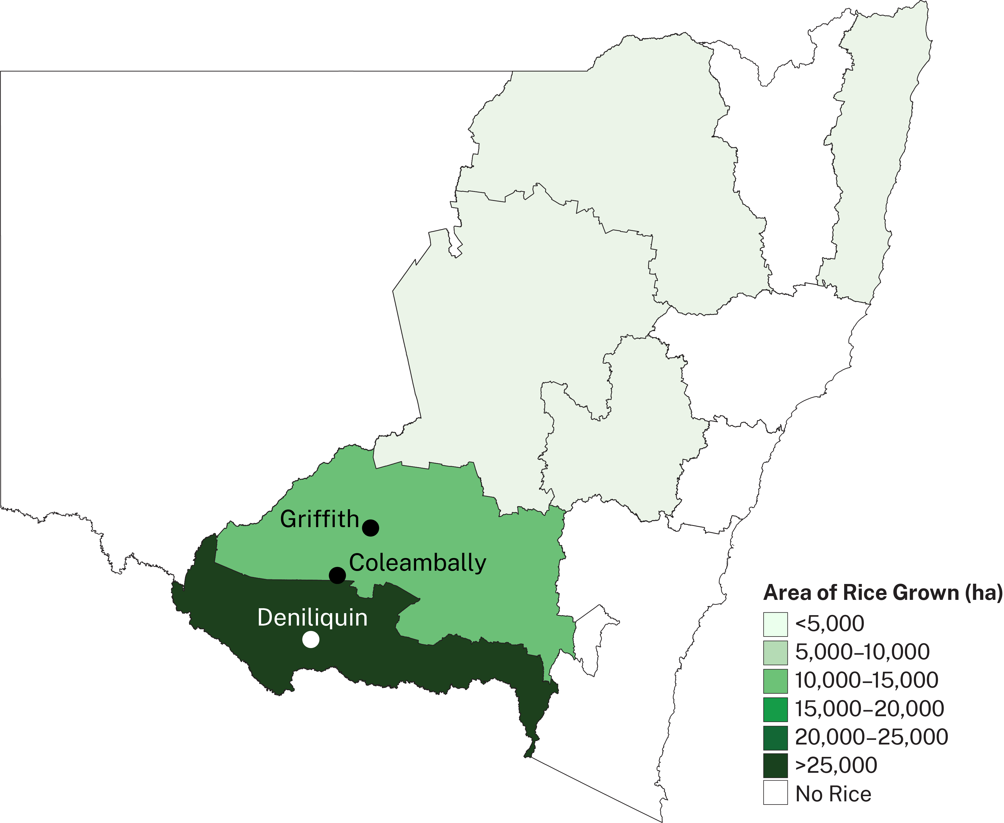
Almost all of Australia’s rice production occurs in the Murray and Murrumbidgee regions of southern NSW. The map shows major NSW rice growing regions. Darker colours represent larger areas of rice grown. These regions have clay-based soils and flat land suitable for mechanised rice production. These regions also have well-developed irrigation infrastructure and rice storage and milling facilities.
The key rice phenophases assessed in this project were establishment, vegetative growth, panicle initiations, microspore, flowering and grainfill. A rice crop with a yield of 12t/ha has been modelled in this assessment.
What is the NSW DPI Climate Vulnerability Assessment? ⏷
Climate change is altering the growing conditions for many agricultural commodities across NSW. Primary producers need evidence-based information about the changing climate, and the risks and opportunities it may bring.
The NSW DPI Climate Vulnerability Assessments are enhancing the resilience of our primary industries by providing information and data to help the sector better plan for, and respond to, climate change. They have assessed climate change impacts for extensive livestock, broadacre and irrigated cropping, marine fisheries, forestry, horticulture and viticulture, and important biosecurity risks associated with these industries to inform sound planning, risk management and adaptation decisions.
How we assessed climate suitability ⏷
Climate projections were sourced from Climate Change in Australia’s ‘Application Ready Data’. This dataset is comprised of projections from an ensemble of 8 global climate models, each presenting a plausible future climate. The models differ in their projections, giving rise to uncertainty which is reflected in the confidence statements given in brackets. Care should be taken when interpreting these results.
The Climate Vulnerability Assessment is intended to highlight potential industry- or regional-level changes. Intermediate and high emissions scenarios were used in the assessments (RCP4.5 and RCP8.5), but these are not the only future scenarios possible. The inclusion of climate variables important to the commodities production was based on published research, expert knowledge and data quality and availability.
Learn more in the Climate Vulnerability Assessment Project Framework.
Climate impacts: what to expect
NSW rice growing regions are likely to maintain high to very high climate suitability for rice production by 2050 under both emissions scenarios, with some areas of minimal increase in suitability.
Irrigated rice vulnerabilities
- Irrigation water requirements are likely to increase in the future, particularly under the high emissions scenario (high confidence).
Irrigated rice opportunities
- Higher minimum temperatures may improve the climate suitability of rice growing regions (moderate to high confidence).
- Projected increases in climate suitability indicate that there may be the opportunity to expand rice production to the eastern Murray Valley region.
Adapting to the changing climate
Adapting to changing irrigation water requirements
- The rice industry may need to be more efficient with water storage and water use by changing irrigation practices or adopting new technologies. Current management strategies and breeding programs aimed at reducing irrigation water use are likely to remain effective and could be used to offset increased plant water use under a warmer climate.
Where can I find the climate suitability maps?
Maps of historical and future climate suitability for commodities were produced to demonstrate where in the state a commodity is likely to thrive or else be limited by future climatic conditions. The maps are not provided on these webpages but can be found in the Climate Vulnerability Assessment Summary Report (PDF, 41425.92 KB).
Irrigated rice Factsheet
(PDF, 8382.07 KB)
Summary Report
(PDF, 41425.92 KB)