Features of the State Seasonal Update (SSU)
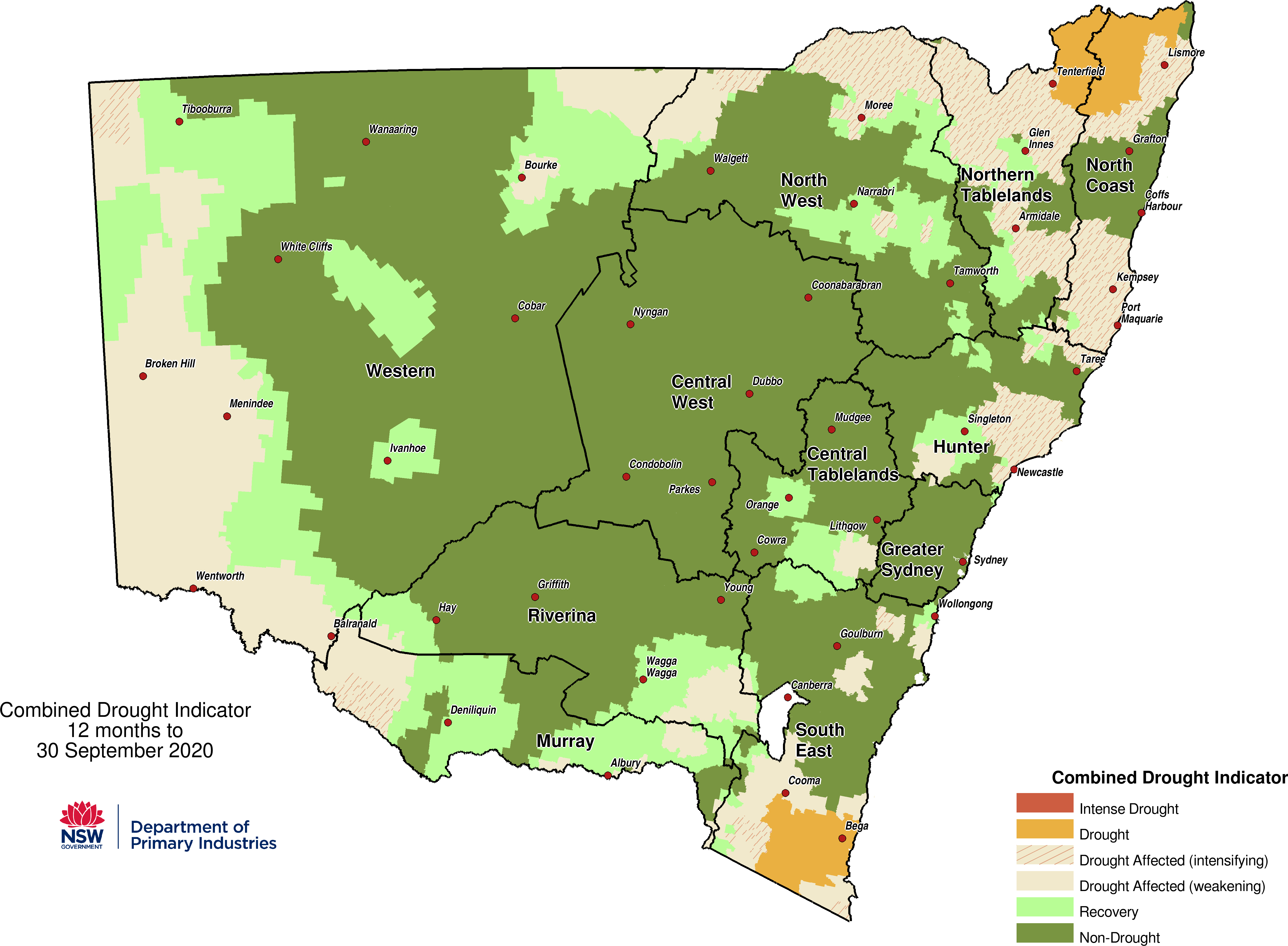
NSW Combined Drought Indicator (CDI) Map
Learn more about the NSW Combined Drought Indicator map.
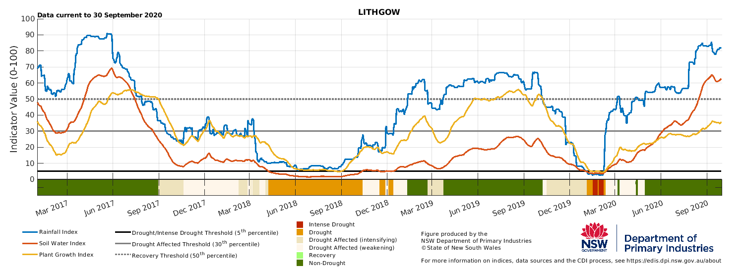
Drought Indicators
Learn about the drought indicators and how they are used to track seasonal conditions over time.
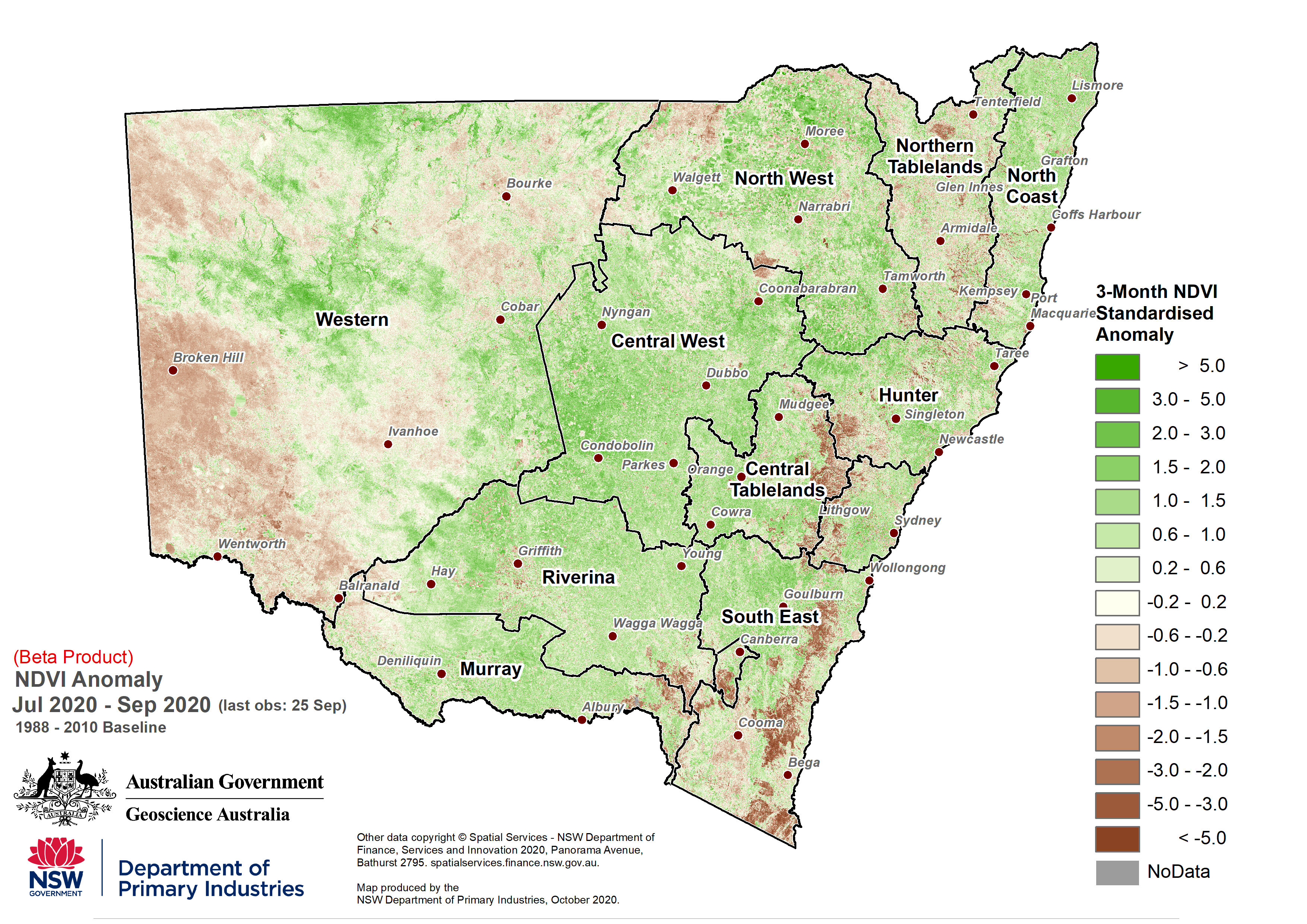
Seasonal Vegetation Index (NDVI)
Find out how remote sensing is used to measure plant health in the State Seasonal Update.
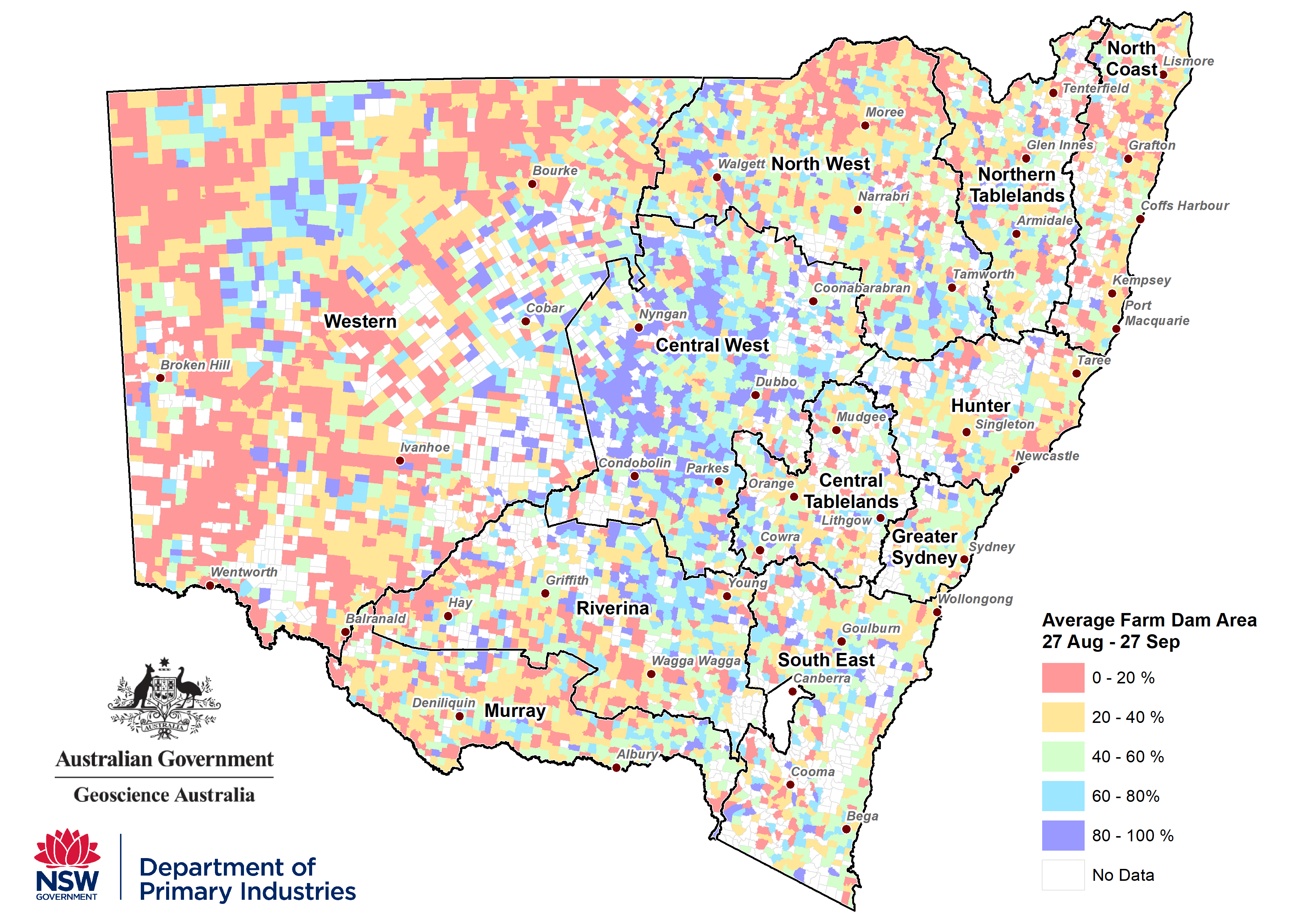
Farm water monitoring in NSW
Learn more about how we assess farm dam water conditions in NSW.