Seasonal Vegetation Index (NDVI)
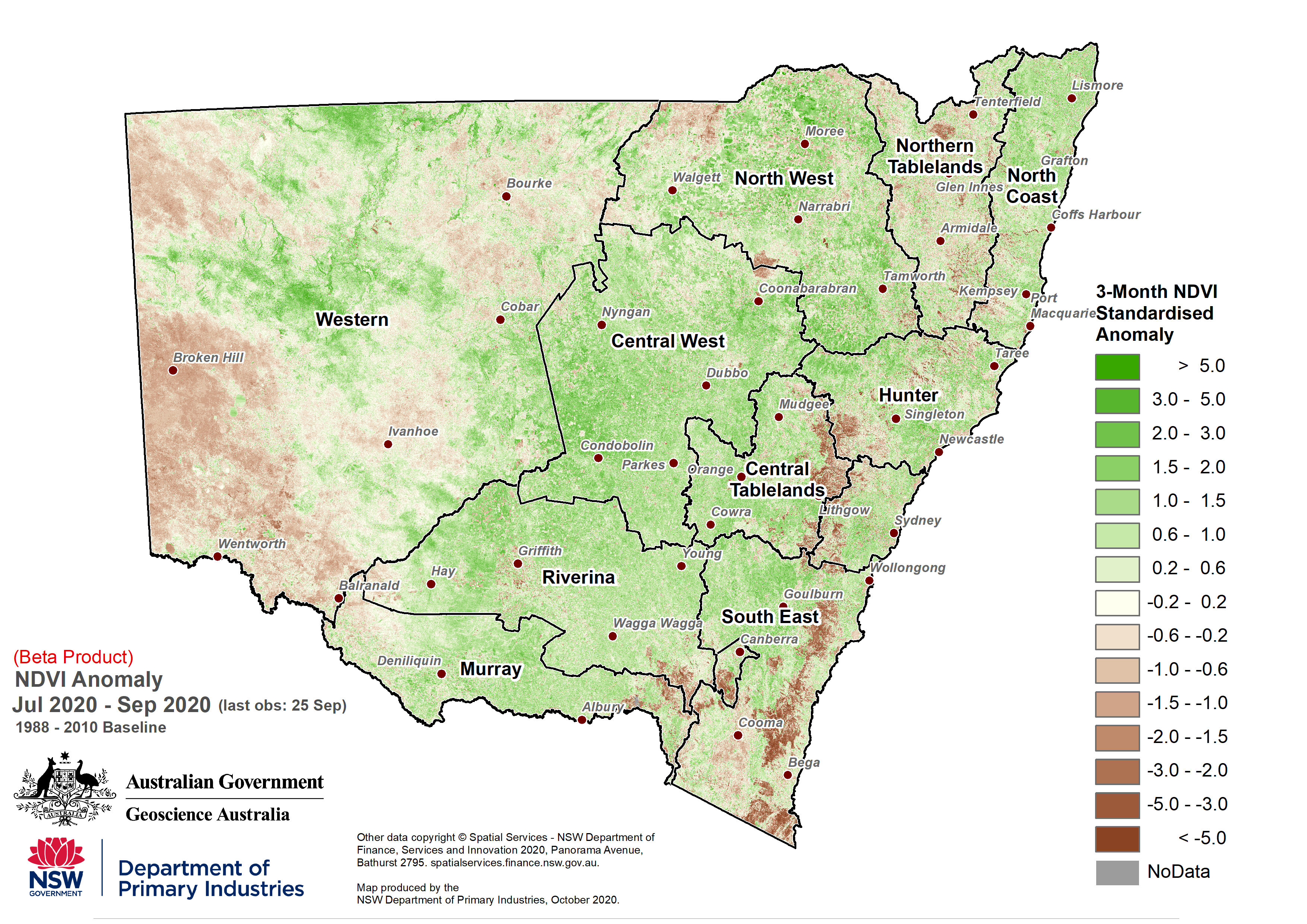
The seasonal vegetation index assessment uses remote sensing information to estimate the amount of green vegetation there is in the landscape. The Normalised Difference Vegetation Index (NDVI) anomaly map in the NSW Sate Seasonal Update provides a seasonal estimate of plant greenness compared to what is expected at the given time of year.
This product has been developed in collaboration with Geoscience Australia's Digital Earth Australia program. The methodology uses the visible and infrared bands from the USGS satellite Landsat to calculate NDVI, which is a useful measure of vegetation density and plant health.
The information collected is quality controlled by Geoscience Australia, which is sourced from the USGS Landsat satellite. The data is provided at a 30m spatial resolution every two weeks. Clouds and smoke can sometimes obstruct observations, causing gaps in the NDVI data or banding in the available imagery. Due to the intermittent image return time, the NDVI is calculated over a three-month period to ensure that there are enough images to provide coverage over the whole state.