Riverbank resilience
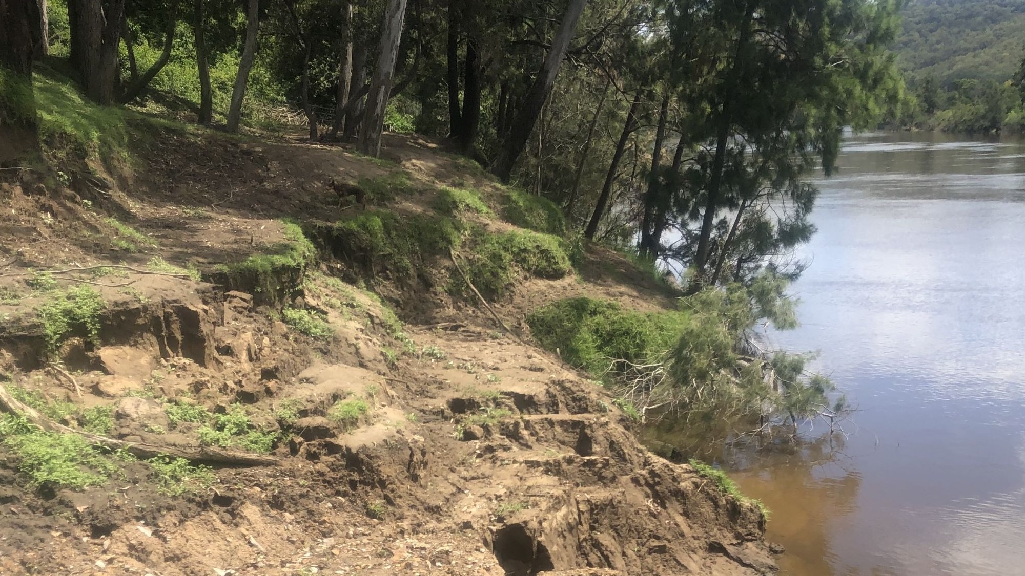
") Bank and riparian areas along the foreshore of estuaries are vulnerable to impacts from flood events, particularly in areas where modification to the banks, or bankside vegetation has occurred. High flow and flooding events result in erosion and adverse impacts to the estuary including loss and degradation of riparian and aquatic habitats, poor water quality, and impacts to land use and public enjoyment.
Bank and riparian areas along the foreshore of estuaries are vulnerable to impacts from flood events, particularly in areas where modification to the banks, or bankside vegetation has occurred. High flow and flooding events result in erosion and adverse impacts to the estuary including loss and degradation of riparian and aquatic habitats, poor water quality, and impacts to land use and public enjoyment.
This action aims to improve or protect estuarine and riparian environmental assets from flood and erosion impacts by implementing best practice, environmentally sensitive designs at actively eroding sites and at vulnerable sites to proactively protect riverbanks and the estuary foreshore during future events.
We will assist Councils, Agencies and Landholders to assess the severity of flood impacts on estuarine assets (both built and natural), identifying and prioritising areas to focus investment in remediation works to maximise environmental outcomes.
On-ground works will provide increased resilience for estuarine assets in future flood events.

Project delivery
Funding for these projects will generally be provided through a grant program. DPIRD - Fisheries will discuss potential projects with prospective applicants and request that they apply. Applications will be assessed on merit. For further information, follow the NEAP Grant program.
As part of this package of works, DPIRD - Fisheries is undertaking comprehensive Bank and Riparian Assessments across 10 estuaries in NSW:
- Bega River
- Tuross River
- Georges River
- Brunswick River
- Richmond River
- Bellinger River
- Clarence River
- Macleay River and
- Wooli Wooli River.
The comprehensive assessments will involve collecting field data along each estuary to the tidal limit and data analysis to identify and target priority areas for works designed to enhance riverbank protection and increase its resilience to future floods.